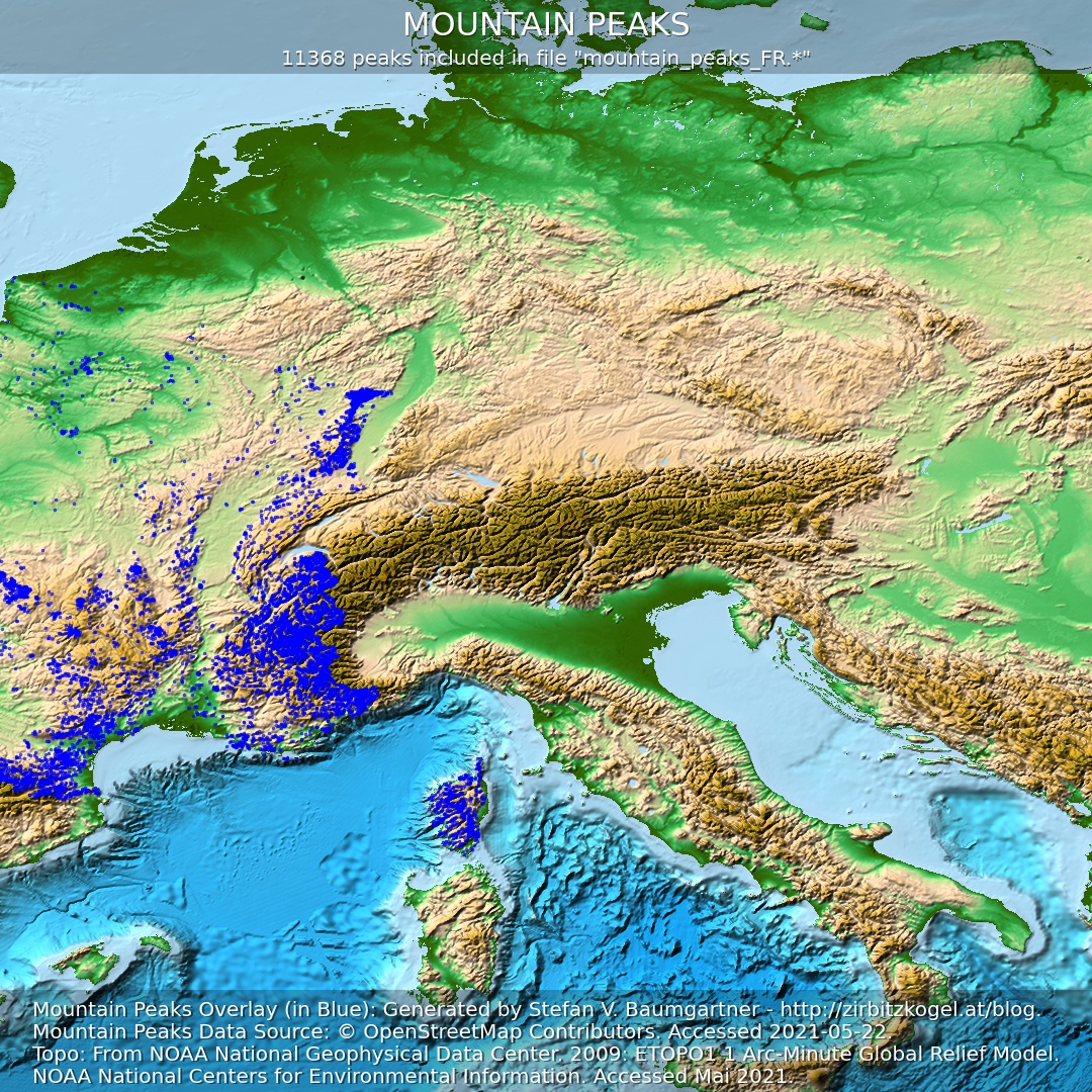
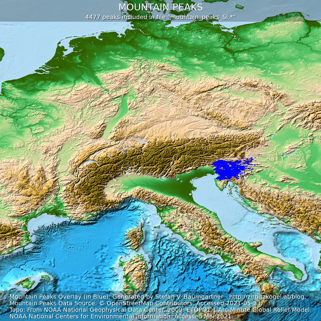
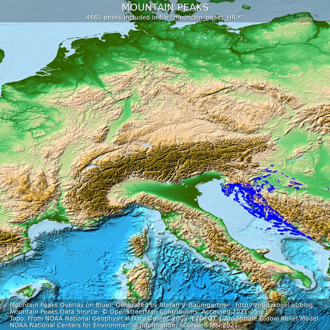
Peaks / Mountain Peaks in SeeYou CUP Format for XCSoar
UPDATE on 17.07.2022: Bug preventing importing files in SeeYou CUP software removed.
UPDATE on 11.01.2022: Bug caused by negative longitude and latitude removed.
UPDATE on 31.12.2021: Mountain peaks of British Isles added for download.
UPDATE on 29.12.2021: Mountain peaks of Pyrenees added for download.
Motivation
Since my summit directory for Google Earth is very well received especially by glider pilots, I decided to offer it for download in SeeYou CUP Format as well.
The SeeYou CUP format is widely used by glider pilots to display waypoints. For example, the freely available gliding computer software XCSoar can be used for visualization.
If you include my summit directory in XCSoar or in comparable (gliding computer) software as a waypoint file, you will see all mountain peaks in the display from a certain zoom level. This can be of great help when you are looking for thermals or want to get the most out of long-distance flying.
Click here to go directly to the download selection!
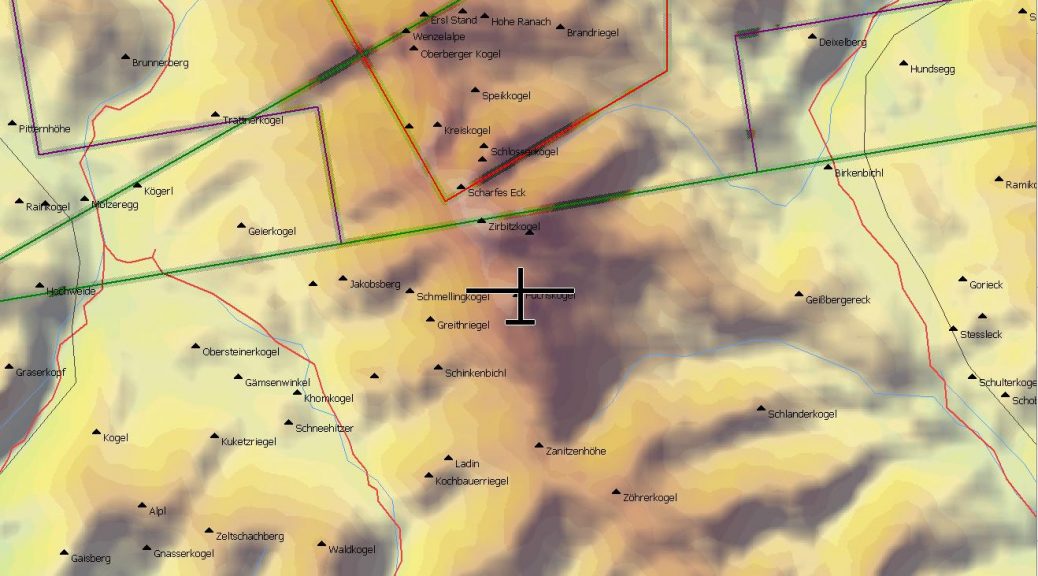
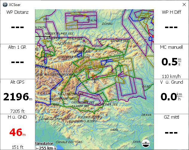
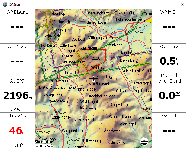
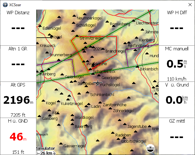
The following figures show some visualization examples of my summit directory with XCSoar. Here the map/terrain database ALPS_Altair.xcm was used as background. Also the Austrian airspace is shown (downloadable from Austro Control).
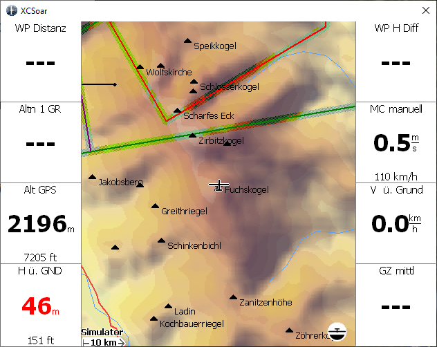
I provide several SeeYou CUP files for Download (see below).
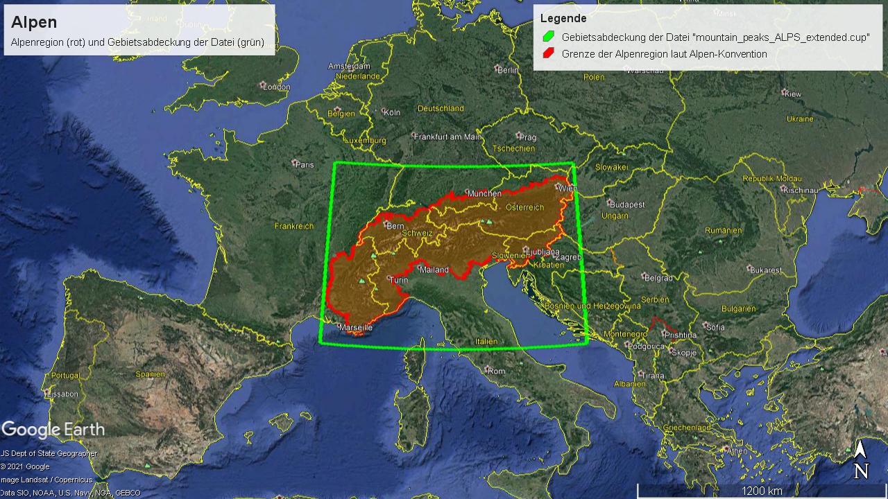
Interesting for glider pilots in the alpine region might be especially the file mountain_peaks_ALPS_extended.cup. This covers exactly the same area as the ALPS_Altair Map, which is often used as a map database in XCSoar.
The Alpine region is completely covered, as the following Google Earth representation shows.
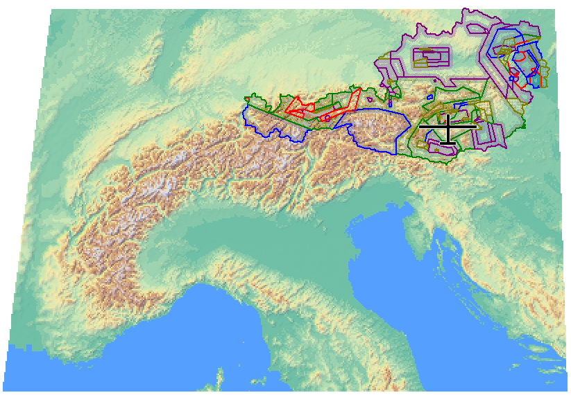
The next figure shows the coverage of the ALPS_Altair Map, which corresponds 1:1 to the area marked in green in the Google Earth representation.
Downloads
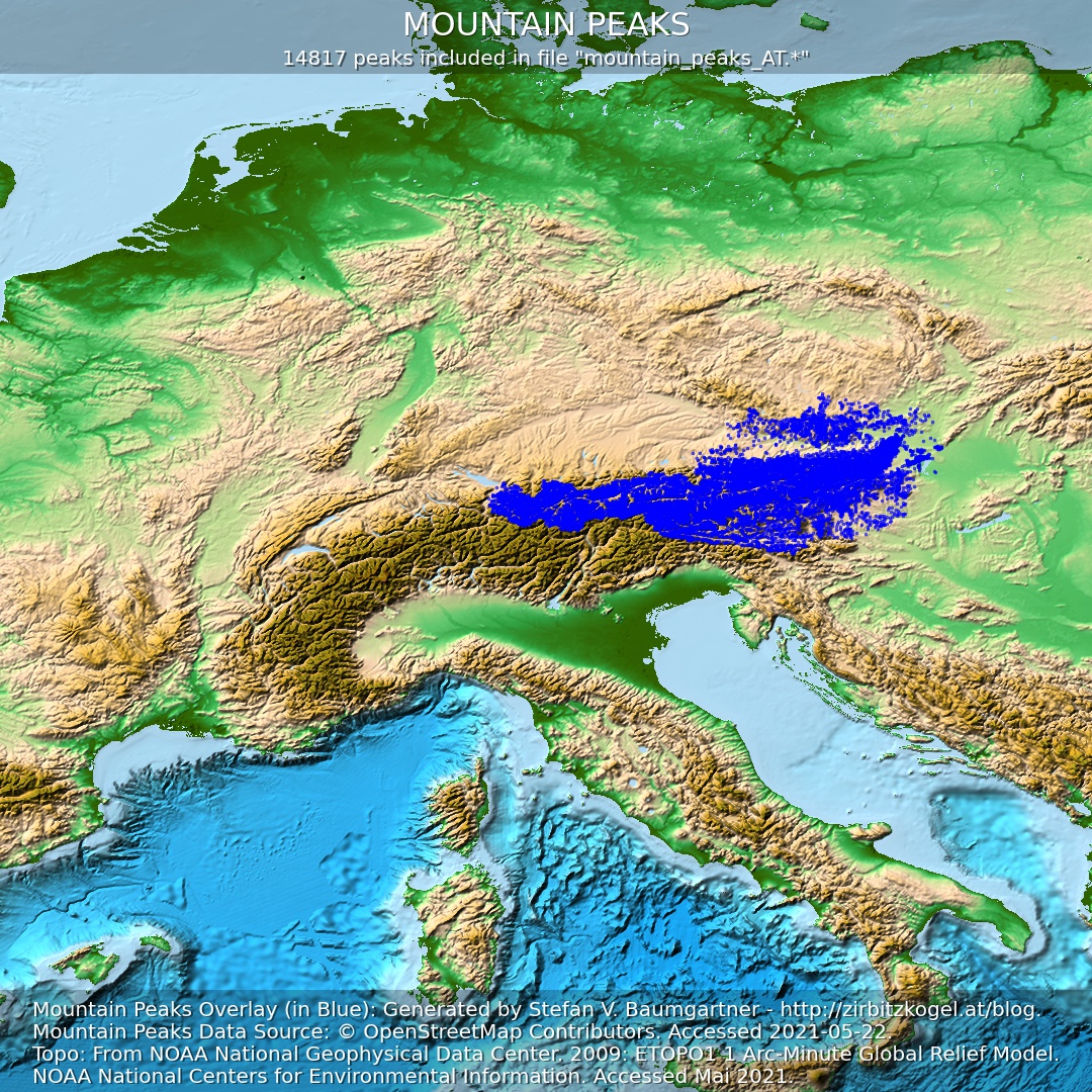
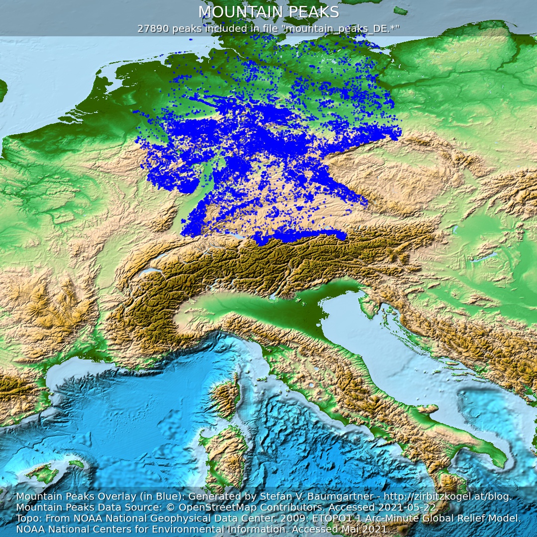
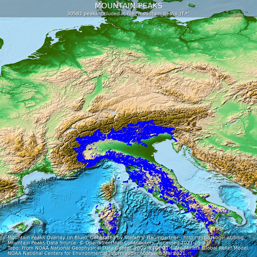
The files listed below may be downloaded, used and distributed free of charge for private, non-commercial purposes. Additionally you are welcome to link to my website for download. If needed, I can also create files with worldwide coverage (contact).
The mountain peaks contained in the SeeYou CUP files I created have been extracted exclusively from OpenStreetMap (link to the data sources used). I cannot guarantee completeness and correctness. Missing elevation data for the summits I filled in with the help of freely available digital elevation models. Especially in the mountains, these elevation models may have larger errors.
I point out that the files are not suitable for instrument flight or IFR conditions. I do not assume any liability for damages of any kind resulting from accidents or other difficulties. The responsibility for the choice of the flight route, the assessment of the personal capability as well as the dangers lies with each pilot himself.
Please read the Terms of Use before using the downloaded SeeYou CUP files.
 Mountain Peaks of the Extended Alpine Region
Exactly matching the cover of the ALPS_Altair-Karte.
mountain_peaks_ALPS_extended.cup (ca. 4990 KB)
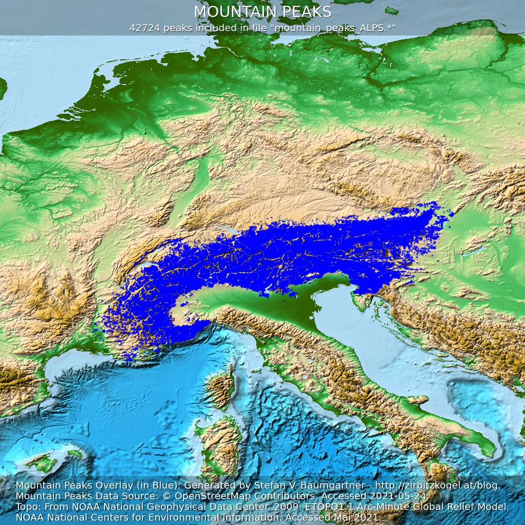 All Mountain Peaks of the Alps
Exclusively peaks belonging to the alps.
mountain_peaks_ALPS.cup (ca. 3080 KB)
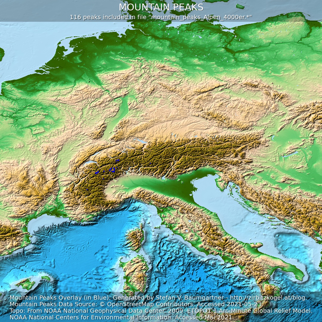 4000 m Peaks of the Alps
Peaks of the Alps that are at least 4000 m high. According to UIAA, 82 of them are distinct main peaks (see liste of mountain peaks of the Alps over 4000 m).
mountain_peaks_Alpen_4000er.cup (ca. 20 KB)
 3000 m Peaks of the Alps
Peaks that are at least 3000 m high but lower than 4000 m.
mountain_peaks_Alpen_3000er.cup (ca. 340 KB)


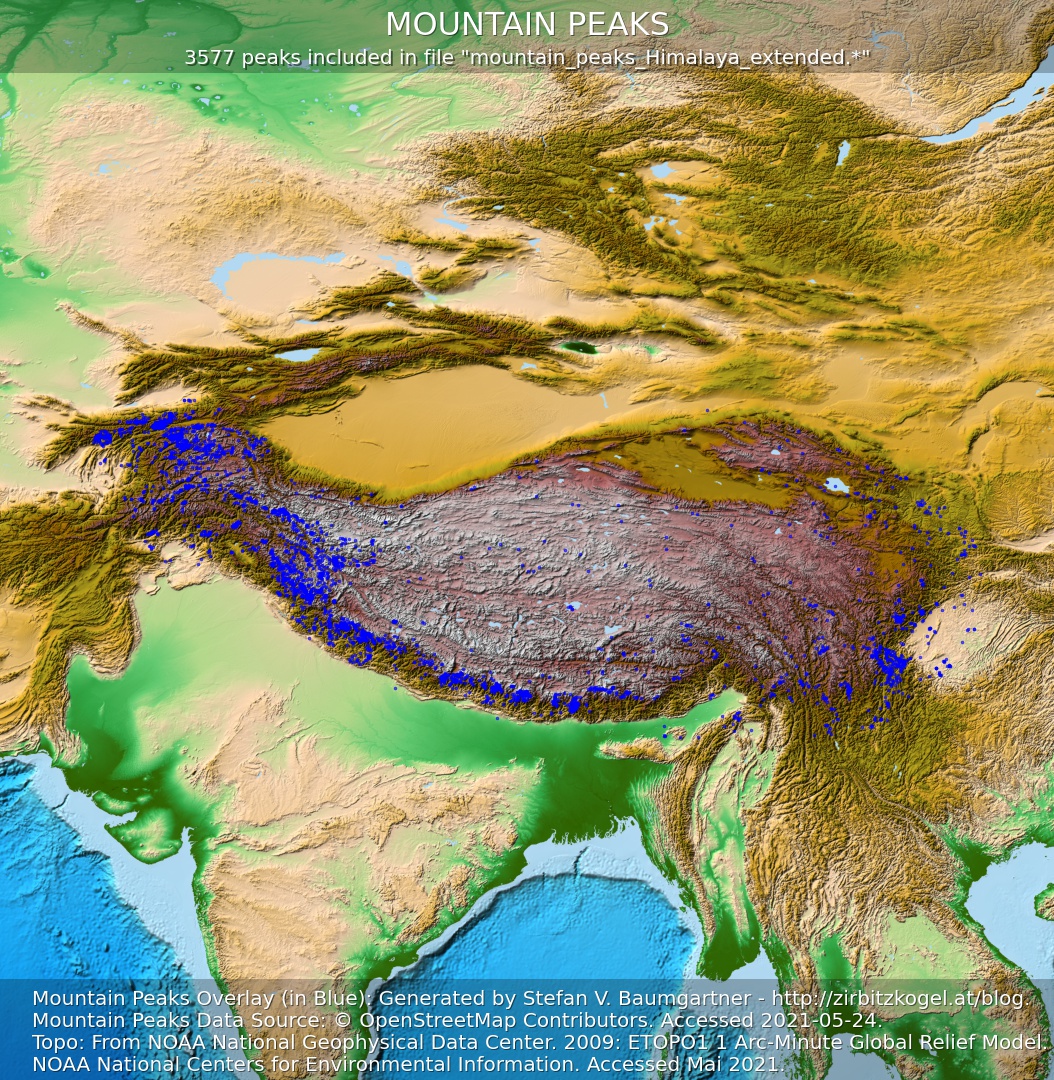 Gipfel Mountain Peaks in the Himalaya, Karakorum, Pamir, and Tibetan Plateau
mountain_peaks_Himalaya_extended.cup (ca. 250 KB)


Please read the Terms of Use before using the downloaded SeeYou CUP files.
For hikers, mountaineers and other interested people I offer the summit directory also in Google Earth’s KML/KMZ format for download at the following link:
Gipfelverzeichnis / Gipfelliste für Google Earth
For Those Interested in Technology
All those who want to know how I created the SeeYou CUP files and also the KML/KMZ files and what effort is behind them should have a look at the following figure.
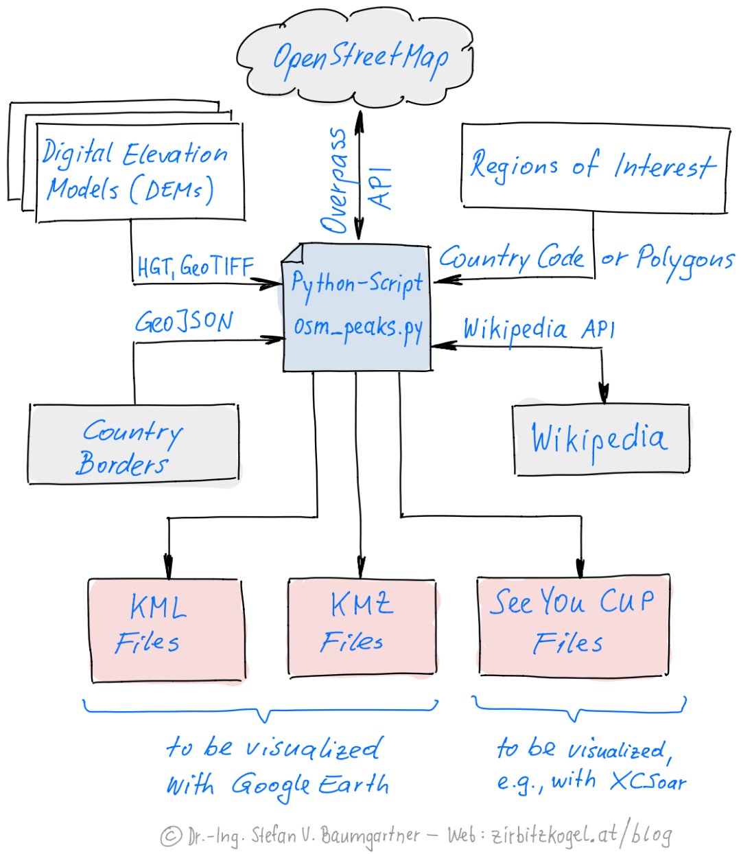
My self-made Python program osm_peaks.py extracts for desired areas all mountain peaks contained in OpenStreetMap. Technically, the mountain peaks are so-called nodes, which are marked as natural=”peak” in OpenStreetMap. The desired areas are defined either by the international country code or by polygons.
In addition, GeoJSON files with the country boundaries can be included, which are used, for example, when generating the files of the Alpine region to assign the individual peaks the country code, which is relevant for the SeeYou CUP files, by reverse geocoding.
If the elevation of a peak is missing in OpenStreetMap, it is read from a suitable digital elevation model using the known geographic coordinates of the peak and added to the peak entry in the SeeYou CUP and KML/KMZ files.
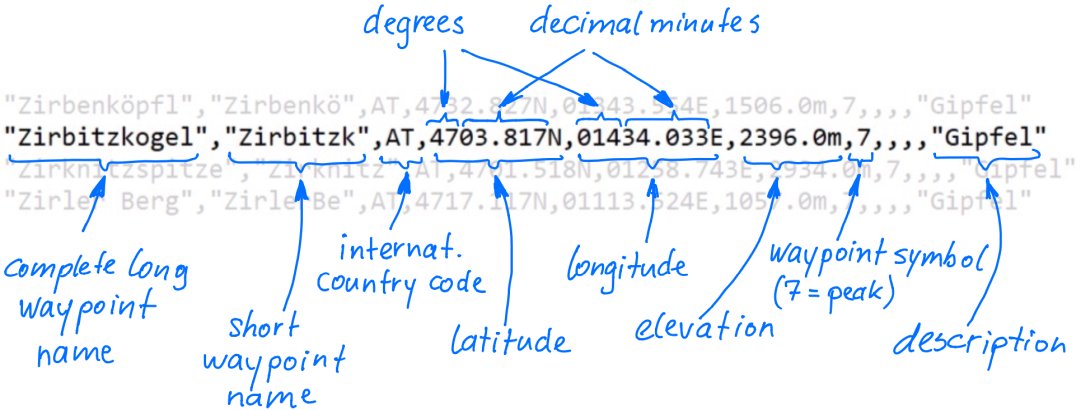
The basic structure and format of the SeeYou CUP files I generate is shown in the following figure.
Details about the standardized KML format used for representations in Google Earth are available here. KMZ files are nothing else than ZIP-compressed KML files. The content of both file types can be visulized by drag & drop with the desktop version of Google Earth, among other things.
The KML/KMZ files I generated also contain a link to the Wikipedia article and to the first photo contained in the Wikipedia article (see here for details). To find the Wikipedia article, the Wikipedia API is used for searching the nearest Wikipedia article, which must be within 200 m of the geographic mountain peak position. A link to the OpenTopoMap is created simply by using the geographic summit coordinates.
Data Sources and Credits
Geographical Positions, Names and Heights of the Mountain Peaks
- Extracted from OpenStreetMap. The data is subject to the Open Data Commons Open Database License (ODbL). © OpenStreetMap contributors.
Where the elevations of the peaks were missing from the OpenStreetMap data, they were added using digital elevation models in the SeeYou CUP files and in the KML/KMZ files. The following elevation models were used:
Elevation Models for Peaks Within Europe
- LiDAR elevation model compiled by Sonny (Website: https://data.opendataportal.at/dataset/dtm-europe; email: sonnyy7@gmail.com) from various freely available OpenData source data (CC BY 4.0). Any LiDAR gaps were filled by Sonny using SRTM data.aus verschiedenen frei erhältlichen OpenData-Quelldaten (CC BY 4.0).
- Elevations of peaks in Europe not covered by the above LiDAR elevation model were filled with the help of the “Copernicus WorldDEM-30 © DLR e.V. 2010-2014 and © Airbus Defence and Space GmbH 2014-2018 provided under COPERNICUS by the European Union and ESA; all rights reserved. The organisations in charge of the Copernicus programme by law or by delegation do not incur any liability for any use of the Copernicus WorldDEM-30”.
Elevation Models for Peaks Outside Europe
- SRTMGL1-Höhenmodell: NASA JPL (2013). NASA Shuttle Radar Topography Mission Global 1 arc second [Data set]. NASA EOSDIS Land Processes DAAC. Accessed 2021-05-23 from https://doi.org/10.5067/MEaSUREs/SRTM/SRTMGL1.003
Country Borders in the Alps
- For reverse geocoding, which is necessary for the creation of the SeeYou CUP files of the Alps in order to assign country codes to the individual peaks, the country boundaries in GeoJSON format were obtained from the OpenStreetMap based service OSM-Boundaries.
Closing Remarks
I would be very pleased about a feedback to my moutain peak list. Wishes, suggestions and error corrections I gladly accept by email.